Google Hiking case study
Adding a feature to Google Maps
Duration:
4 weeks (80 hours)
Role:
UX Researcher, UX/UI Designer

Project overview
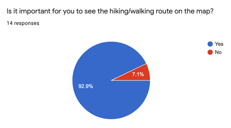
Problem statement
The hiking and spending time outdoors has become more popular because it helps to clear the mind, reduces stress, see beautiful places and enjoy. People can find a hiking area on Google Maps, but they don't see the route and the distance to it. Therefore, many people use other apps such as AllTrails.
Solution
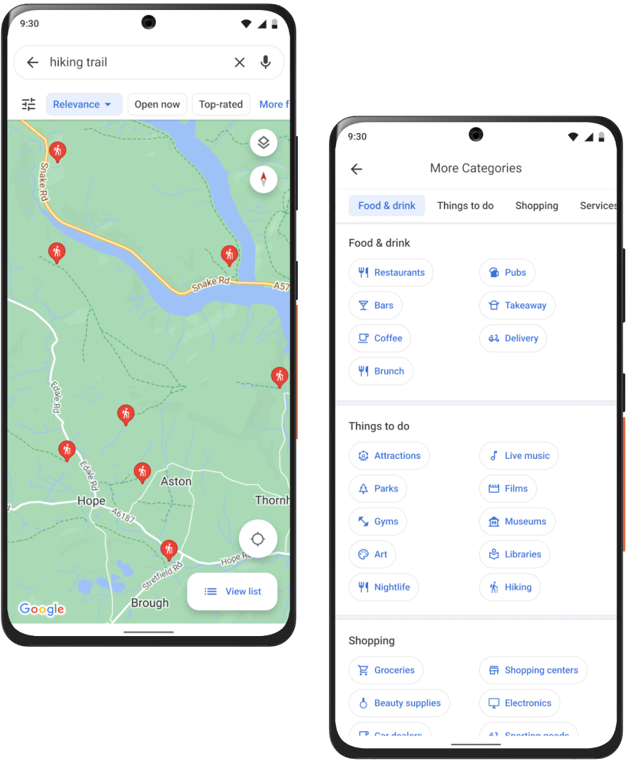
Add the ability to view all hiking areas with the route and distance (this will be in the "Things to do" category). Google Maps already has the ability to create and save your own route (but only to yourself or share via a link and so on), so add the ability to create your own hiking trail and add it to the map for other people to see.
project timeline
I only had 2 weeks (80 hours) for this project.

research phase
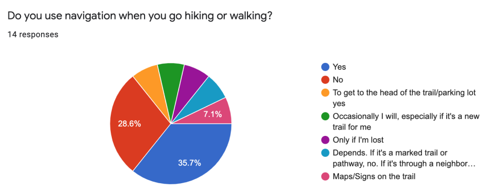
Survey
Before compiling the list of questions, I asked myself, “Why am I doing this survey? What information do I expect to receive? How will this information help me create this feature?”. Keeping these questions in mind I created the survey.
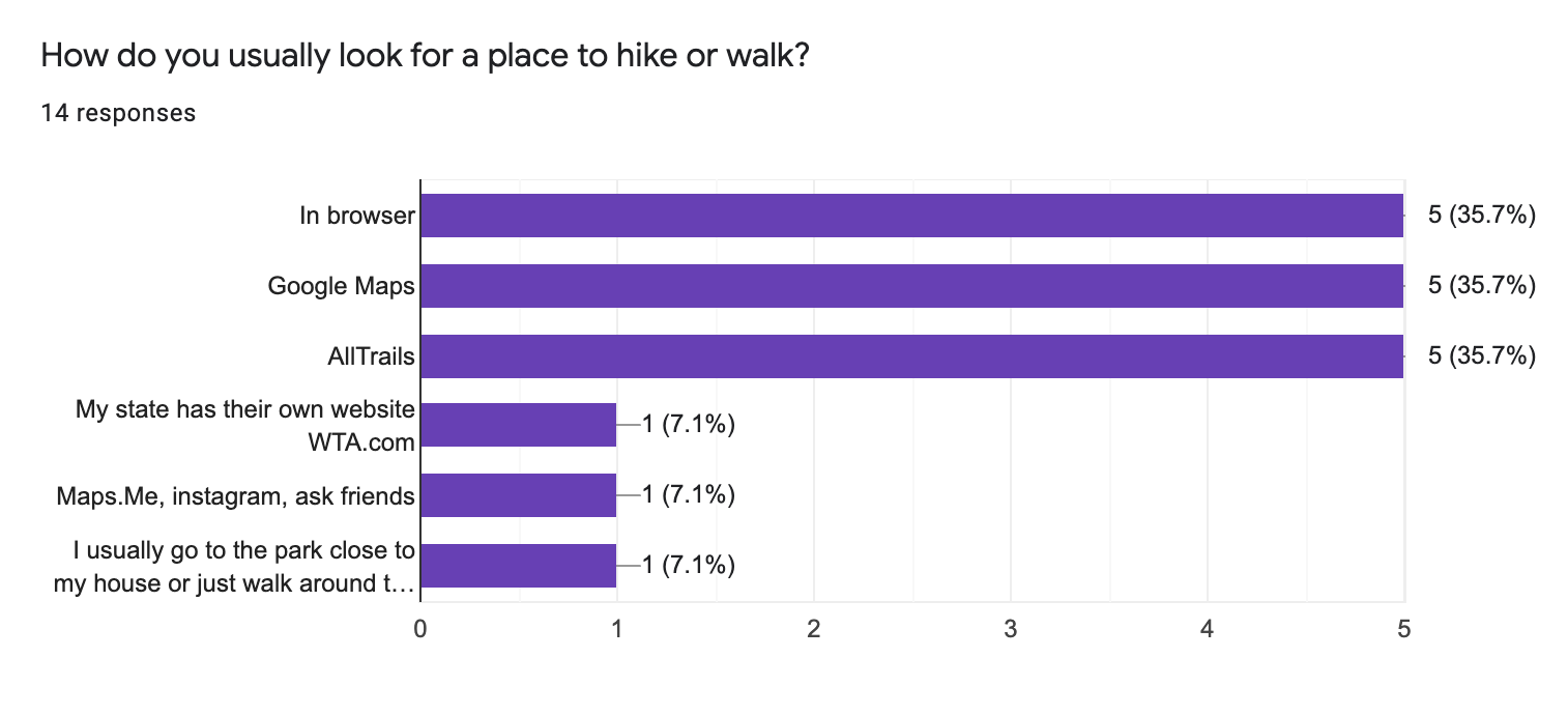
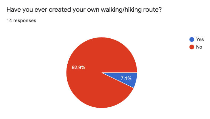
People search for walking/hiking trails in the browser or use Google Maps, AllTrails, or other apps and websites
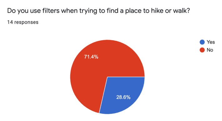
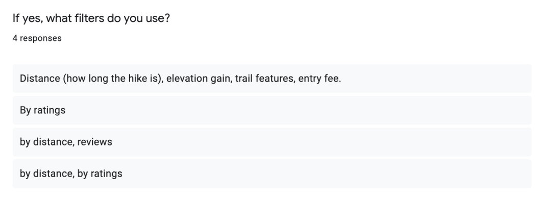
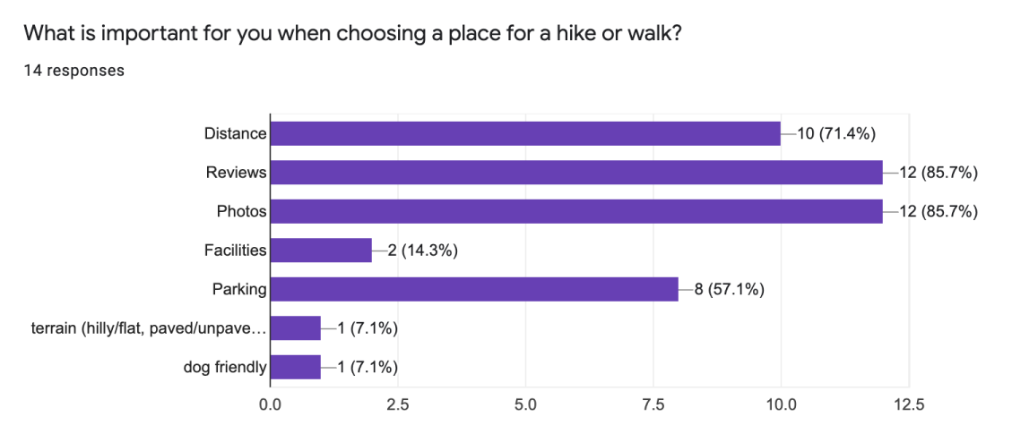
Distance, reviews, photos, and parking are the most important things when choosing a route.
“Not exactly walking or hiking, but I did create my own route around the town to run. I mapped out the approximate distance using Google Maps before heading out.”
User Persona

User Story
I created user stories to focus on why the user needs this feature, what he/she expects from this feature. It also helps me find a solution.
user flow
I created a User Flow just for the “Find Hiking Trail” feature on the Google maps.

Design phase
Paper sketches
I drew some basic screens to get an idea of what it would look like.

Wireframes

Usability study
Partisipants:
3 participants aged 23-55 who love hiking
Test Objectives
- Observe how participants complete the task
- Observe to the difficulties that the user encounters when working with the interface
Insights:
- Add the length of trail in steps;
- Add the ability to see a camping sign, barbecue area, etc. on the trail.

Hi-fi wireframes
Where are you going to go today?
Find your favorite trail by search or categories.
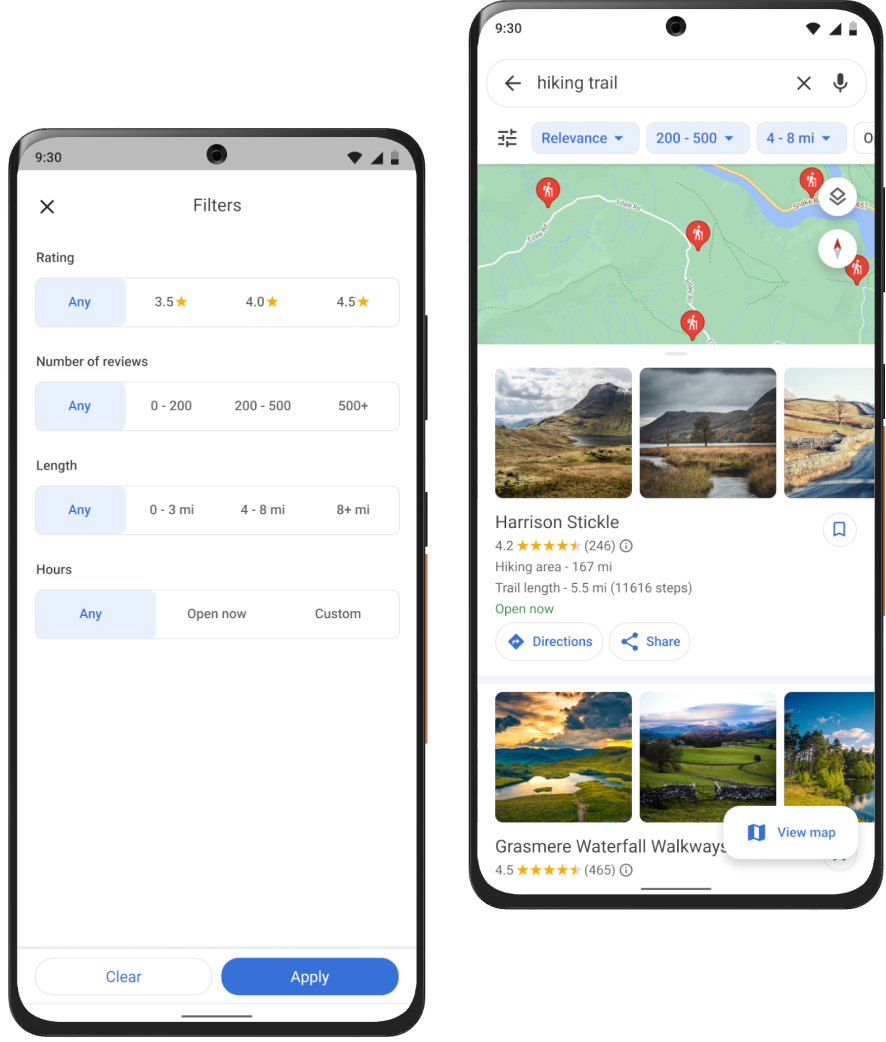
Want to find a trail of a certain length?
Use filters!
Filters allow user to filter by rating, number of reviews, length and hours.

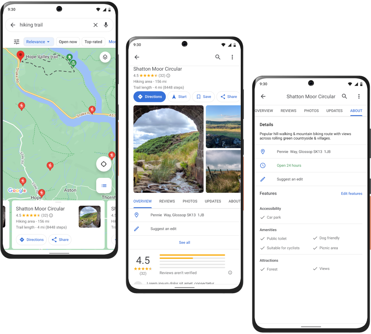
Ability to see:
- The route on the map;
- The length of the trail in miles and steps;
- Information about the trail(facilities, attractions)

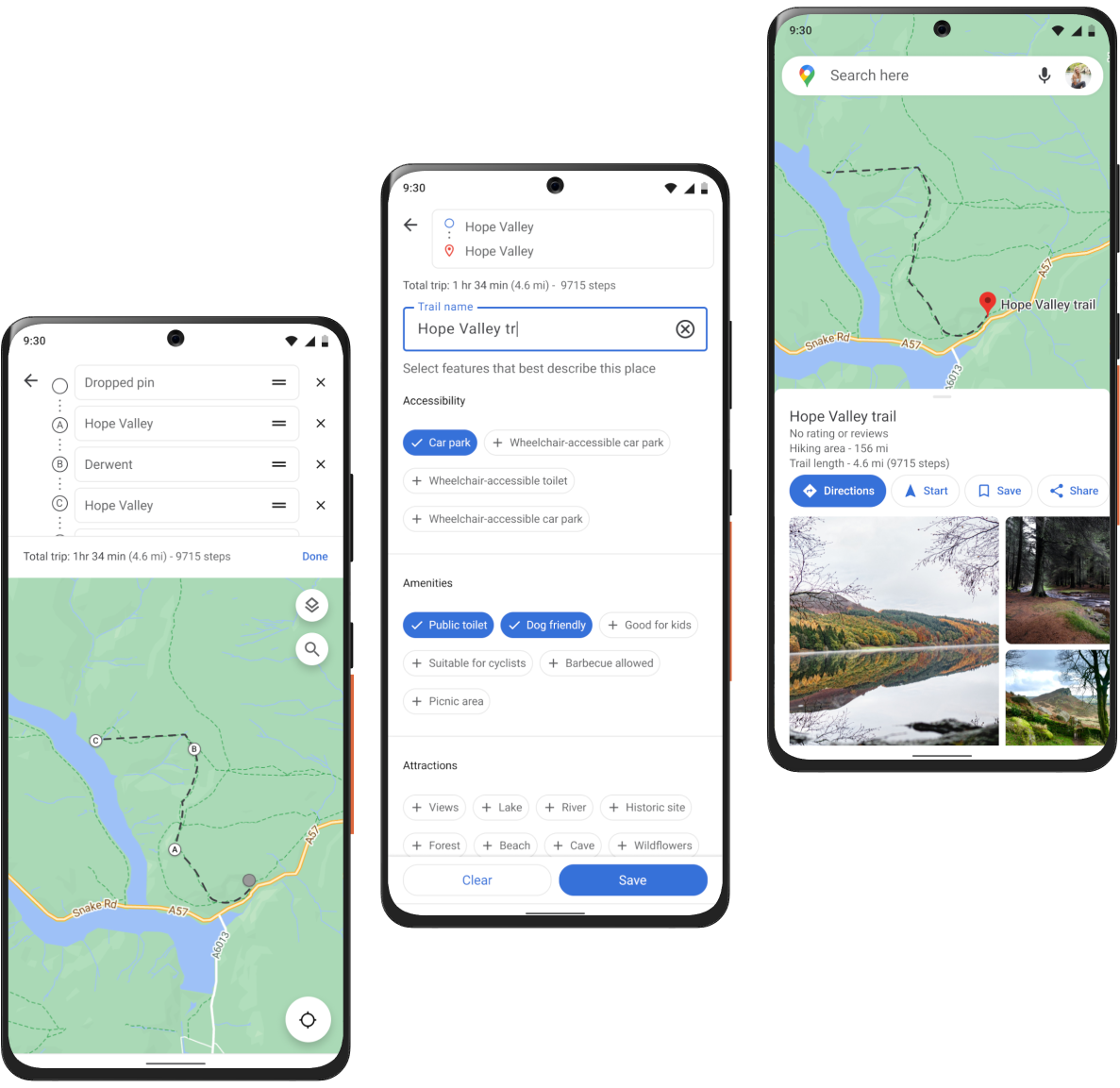
Ability to create your own hiking trail in just 4 steps:
- Create the route on the map;
- Come up with a trail name;
- Select features;
- Save it
All screens
